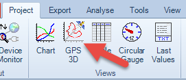
The function 'GPS 3D' will display data with embedded GPS information in a 3D diagram. The GPS 3D View shall neither substitute the related function in Google Earth nor has it a comparable scope of operational functions. This option is only to display the GPS Track in a simple and easy way from various sides.
The GPS View shows always a full completed dataset. Once the data have been read to display the graphic Chart they can not be changed anymore - beside some visual options.
To create this GPS 3D View it is necessary that GPS coordinates are available inside the dataset. Normally they are specially marked direct from the device itself. LogView Studio will detect and analyze these informations accordingly. In case there are no GPS data available or not detected, a related message will appear.
Menu Section
Views
Hierarchy level
Sub element of a Dataset
Procedure 'GPS 3D'
| • | Select a device within your project |
| • | Select 'GPS 3D' in the Views Section of the Menu 'Project' |
| • | The GPS View chart will be created as Sub-element of the dataset |
Note
The quantity of GPS 3D Views in LogView Studio is unlimited. It is also possible to create more than one GPS 3D View for the same dataset.